3D Terrain in MapLibre
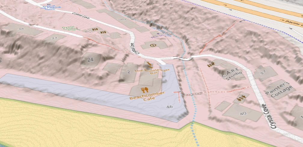
Creation of terrain tiles from LIDAR data for a detailed 3D effect.
Experience in geospatial analysis using ESRI, QGIS, Javascript, Python, GDAL and customized scripts. (LinkedIn profile)
Creation of terrain tiles from LIDAR data for a detailed 3D effect.
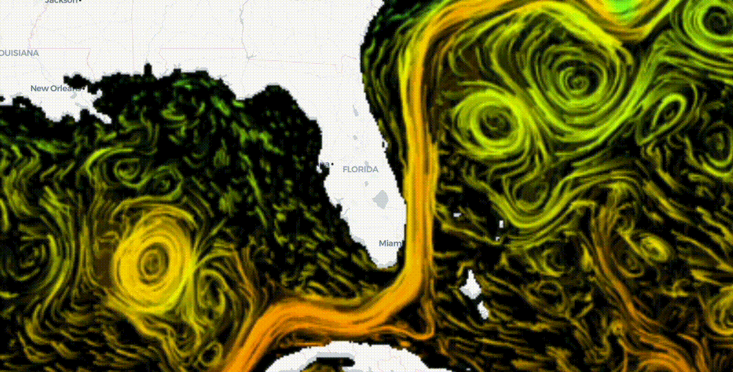
Use of an animated layer in a map.
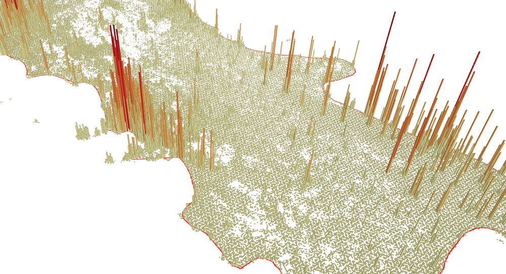
Work with large amounts of point data binned in a hexagon 3D format. Hold the "shift" key, while clicking the mouse to spin and change the camera angle.

Creation of raster tiles (slippy maps). Colab notebook showing how to create map using GDAL2Tiles
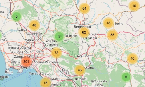
40,000 surnames in Italy mapped out and shown dynamically.

Using "maplibre-gl-compare.js".
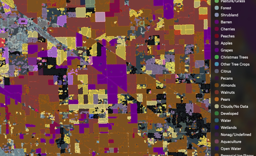
Using Python libraries (Rasterio, Geopandas and Numpy), convert a raster of crop designations to a vector format (GeoJSON and Geopackage).
Using Meta's Segment-Anything in a geospatial setting.
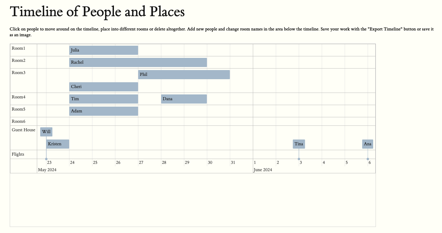
Create interactive timeline, spanning days or centuries. Uses JSON for import/export.
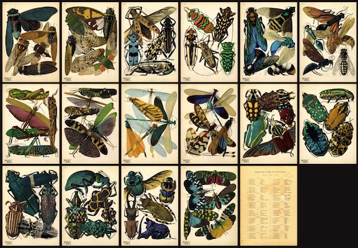
Using IIIF images, OpenSeadragon and Annotorious to view an image collection.